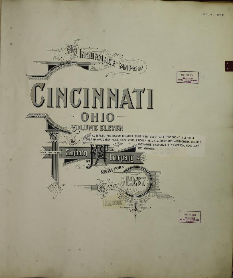
Map 1: Sanborn Map, Circa 1934–1937
This map shows Lincoln Heights with a significantly larger geographic footprint than it holds today. The layout includes roadways that reflect a growing village shaped by the families who lived and built there long before the area was officially incorporated.
Map 2: Sanborn Map, Circa 1937–1950
In stark contrast, this second map presents a reduced land area. A significant section of the original land has been whited out or obscured. Even more curiously, a printed statement referencing espionage appears across the top of the document, a highly unusual element for a fire insurance map.
Uncovering the Hidden History: What the Sanborn Maps Reveal About Lincoln Heights
In 2024, the Lincoln Heights Ohio Historical Society received a remarkable contribution from long-time resident Bill Franklin, two Sanborn fire insurance maps, sourced from the Library of Congress, that may offer critical insight into the history of Lincoln Heights and its boundaries before and after incorporation.
A Tale of Two Maps
The first map, dated between 1934–1937, indicates a significantly larger footprint of the village, including land that residents had built on and lived on for years. The layout suggests a broader vision for Lincoln Heights, one rooted in the beginning of independence and community growth.
The second map, covering 1937–1950, paints a very different picture. Portions of the land from the earlier map clearly shows have been whited out, and most strikingly, an espionage disclaimer was added across the top. This raises serious questions: Why was land removed or obscured? What role did external pressures play in reshaping the boundaries of a self-governed Black community?
What This Could Mean
For many residents, these maps validate long-held suspicions that land was taken from families without explanation—land where homes, businesses, and lives were already established. The appearance of the espionage clause only deepens the mystery, suggesting that there may have been governmental oversight or classified involvement in the development (or restriction) of Lincoln Heights’ growth.
Our Commitment to Research and Truth
The Lincoln Heights Ohio Historical Society is currently conducting further research to:
- Compare and analyze these maps in detail
- Investigate historical records and land use documents
- Interview families impacted by these changes
- Seek academic and archival insight into the espionage language used
We are committed to uncovering the truth and preserving every chapter of Lincoln Heights’ story, even the ones that were nearly erased.
How You Can Help
If you or someone you know has knowledge, documents, or lived experience related to Lincoln Heights’ boundary changes or land use before incorporation, we would love to hear from you. Your stories help complete the picture.
Send us a message here to share what you know or to support this ongoing investigation.